


ORTHEL TWP Voting District, Hancock County, Iowa
About
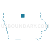
Outline

Summary
| Unique Area Identifier | 582255 |
| Name | ORTHEL TWP Voting District |
| County | Hancock County |
| State | Iowa |
| Area (square miles) | 35.82 |
| Land Area (square miles) | 35.76 |
| Water Area (square miles) | 0.07 |
| % of Land Area | 99.81 |
| % of Water Area | 0.19 |
| Latitude of the Internal Point | 43.11996700 |
| Longtitude of the Internal Point | -93.90782880 |
Maps


Graphs
Select a template below for downloading or customizing gragh for ORTHEL TWP Voting District, Hancock County, Iowa


Neighbors
Neighoring Voting District (by Name) Neighboring Voting District on the Map
- BINGHAM TWP Voting District, Hancock County, IA
- BOONE TWP W/O CORWITH Voting District, Hancock County, IA
- BRITT TWP Voting District, Hancock County, IA
- BUFFALO TWP Voting District, Kossuth County, IA
- CRYSTAL TWP Voting District, Hancock County, IA
- ERIN TWP Voting District, Hancock County, IA
- PRAIRIE TWP W/O WESLEY Voting District, Kossuth County, IA
- WESLEY TWP W/O WESLEY PART Voting District, Kossuth County, IA
Top 10 Neighboring County Subdivision (by Population) Neighboring County Subdivision on the Map
- Britt township, Hancock County, IA (2,273)
- Buffalo township, Kossuth County, IA (685)
- Wesley township, Kossuth County, IA (540)
- Crystal township, Hancock County, IA (435)
- Bingham township, Hancock County, IA (426)
- Orthel township, Hancock County, IA (221)
- Prairie township, Kossuth County, IA (204)
- Erin township, Hancock County, IA (202)
- Boone township, Hancock County, IA (179)
Top 10 Neighboring Place (by Population) Neighboring Place on the Map
Top 10 Neighboring Unified School District (by Population) Neighboring Unified School District on the Map
- West Hancock Community School District, IA (3,893)
- Corwith-Wesley Community School District, IA (1,057)
- Titonka Consolidated School District, IA (1,017)
- Woden-Crystal Lake Community School District, IA (912)
Top 10 Neighboring State Legislative District Lower Chamber (by Population) Neighboring State Legislative District Lower Chamber on the Map
- State House District 11, IA (27,572)
- State House District 8, IA (26,866)
- State House District 7, IA (26,716)
Top 10 Neighboring State Legislative District Upper Chamber (by Population) Neighboring State Legislative District Upper Chamber on the Map
Top 10 Neighboring 111th Congressional District (by Population) Neighboring 111th Congressional District on the Map
Top 10 Neighboring Census Tract (by Population) Neighboring Census Tract on the Map
- Census Tract 2703, Hancock County, IA (2,684)
- Census Tract 9502, Kossuth County, IA (2,541)
- Census Tract 2704, Hancock County, IA (2,189)